Why I Sleep on a Wooden Platform in Sub-Zero Temperatures to Get up in the Dark and Frost to Force Myself Through Activities that Cause Me Physical Pain

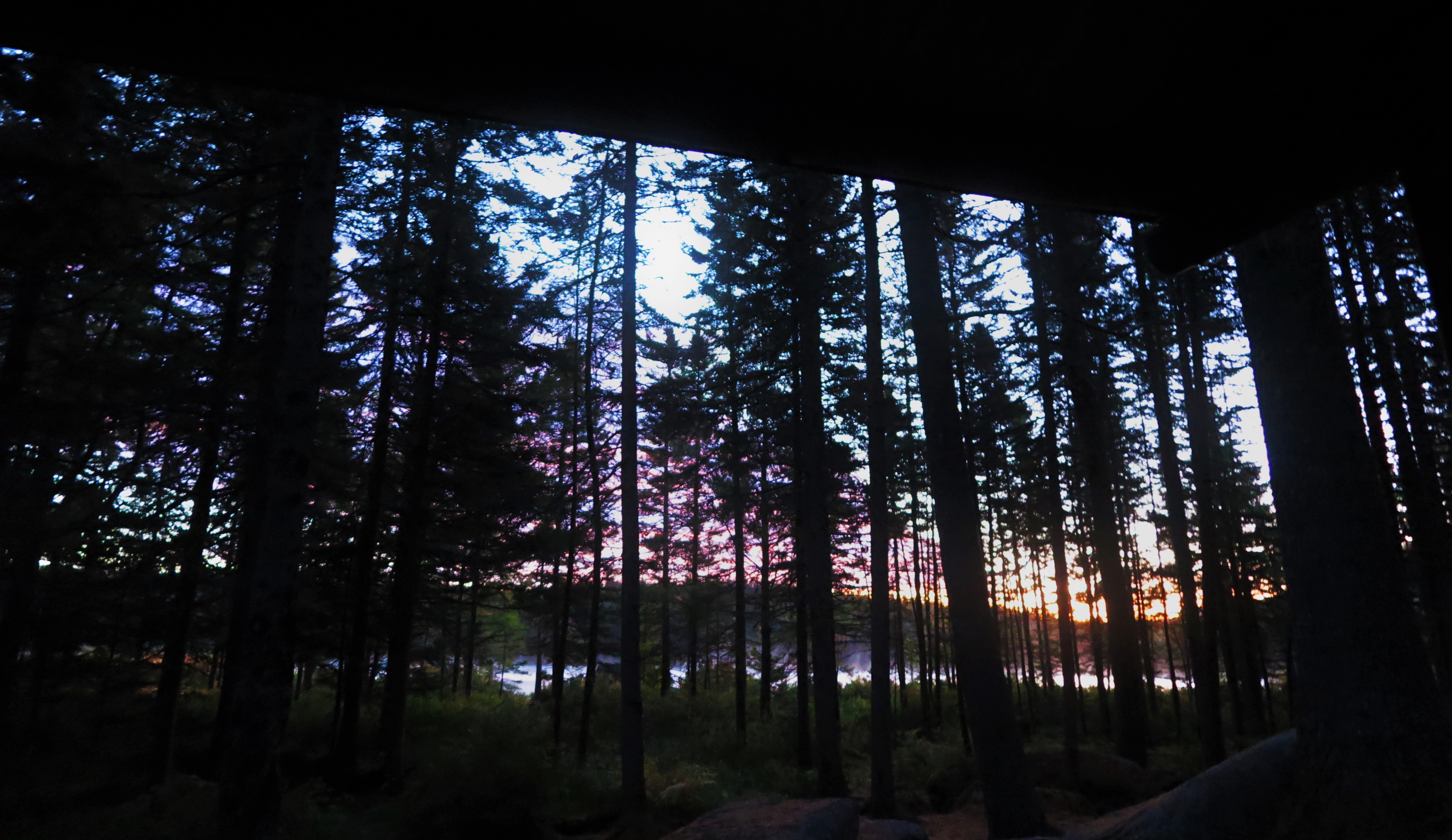
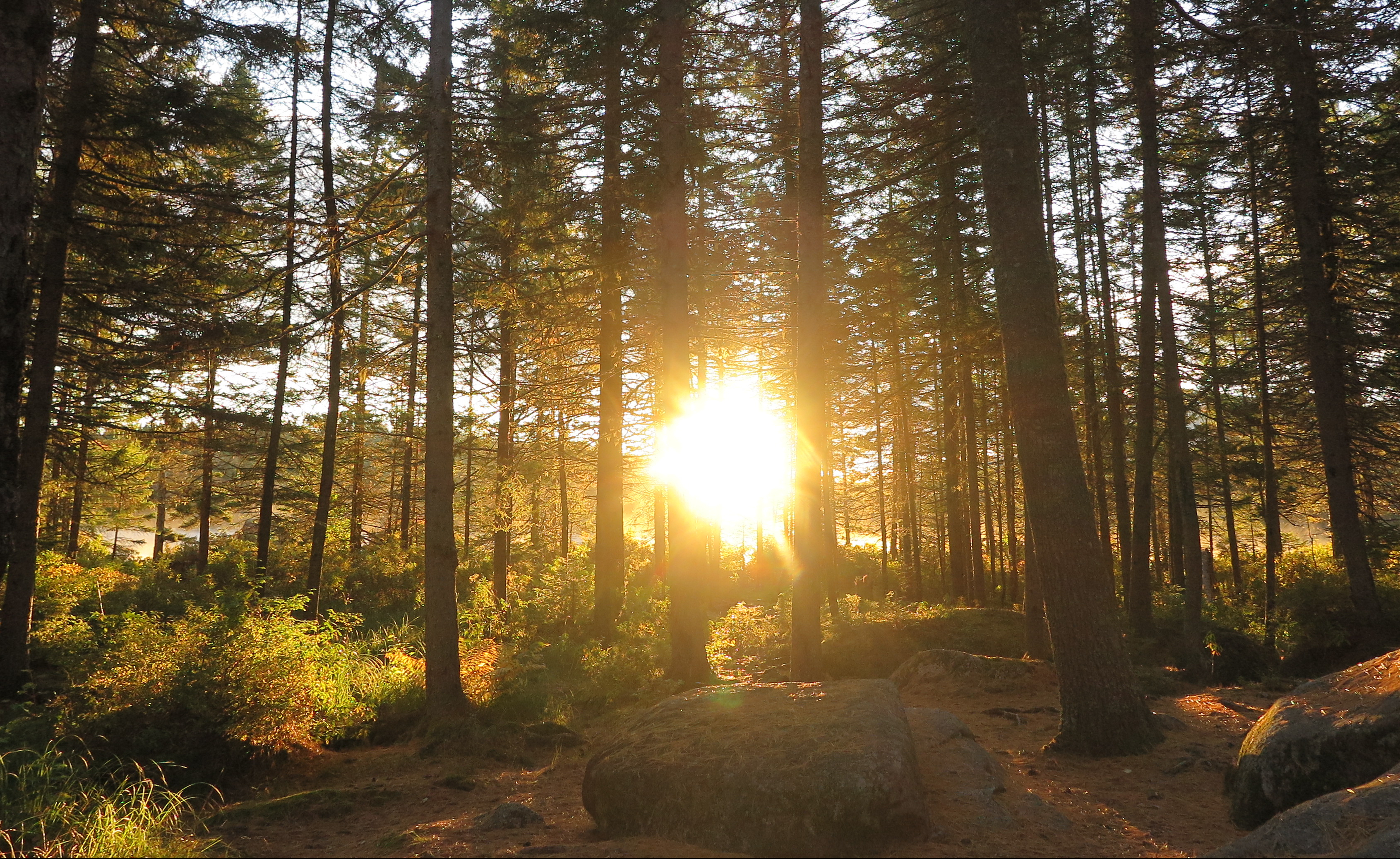
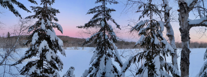
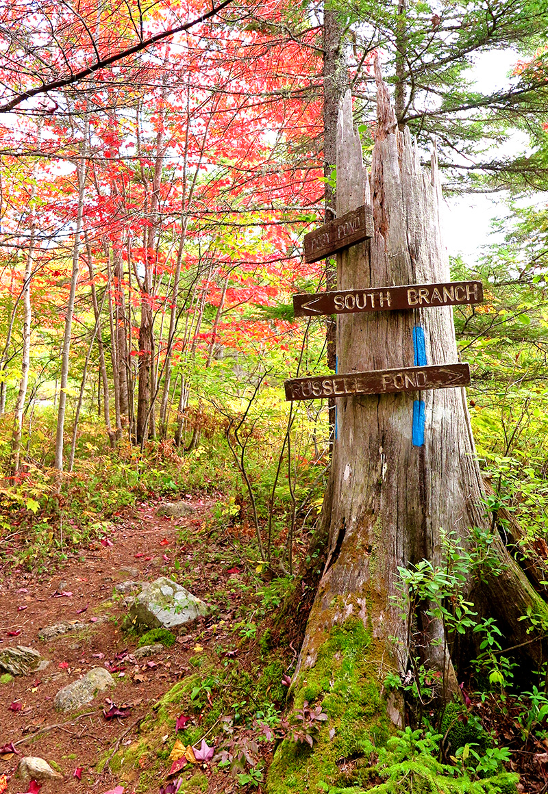
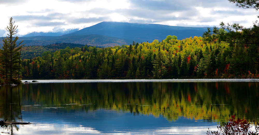
I was posing this question to myself quite seriously recently, as I lay in my sleeping bag in below-freezing temperatures a lean-to in at Russell Pond, a remote hike-in campground in Baxter State Park in Maine. I had intentionally roused myself in the pre-dawn darkness, giving myself time to slowly bring one item of my hiking clothes into my sleeping bag at a time, to warm them up and don each item once it was no longer icy. By the time I had finished this process, I was beginning to see subtle glimmers of light reflecting of the pond through the dark spruce trees.

IMG_0517

Once I awkwardly struggle into each item while still in my bag, I have no more excuses not to get up and out of it. And by get up and out of it I mean un-cinch the bottom so I can stick my feet out and put my boots on and shuffle around camp still “wearing” my sleeping bag. It was cold.

My first priority is coffee. (The passing thought of skipping coffee to hit the trail all the earlier had been quickly dismissed.) This requires untying and lowering my bag of food hung in a tree for the night, to keep it safe from both bears and other smaller – but just as hungry – critters, and getting water from the pond and squeezing it through my filter. The coffee, paired with a gourmet breakfast of gorp and dehydrated squash spiced with cinnamon and sugar (highly recommend, sort of like dehydrated apples with the chewy texture and cinnamon, but a vegetable!), in addition to providing me some nourishment before a big day, allows me to sit (still ensconced in my bag) and enjoy the ever-increasing light reflecting through the trees as the sun made its way closer to appearing over the horizon.

IMG_0520

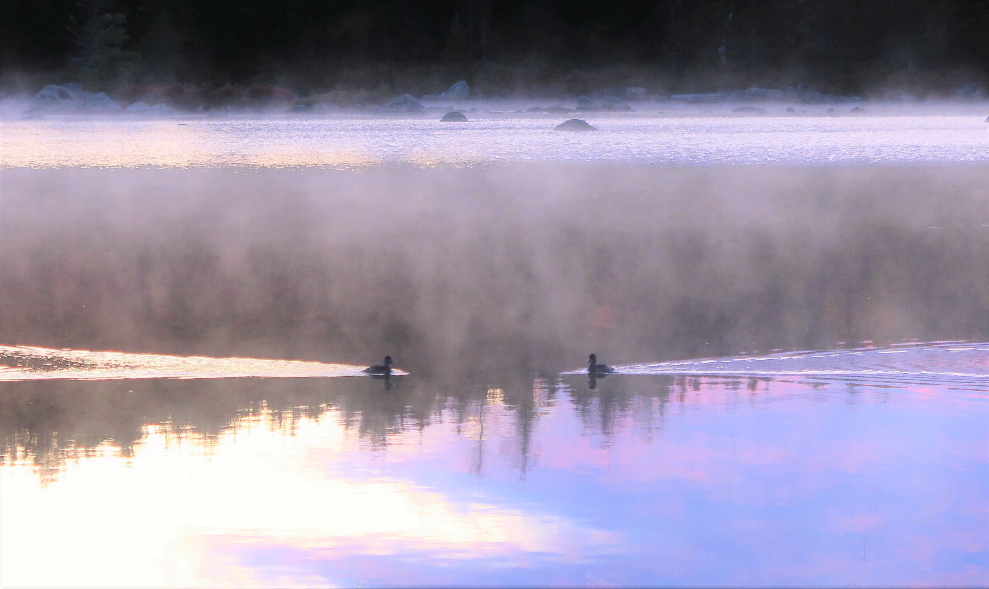
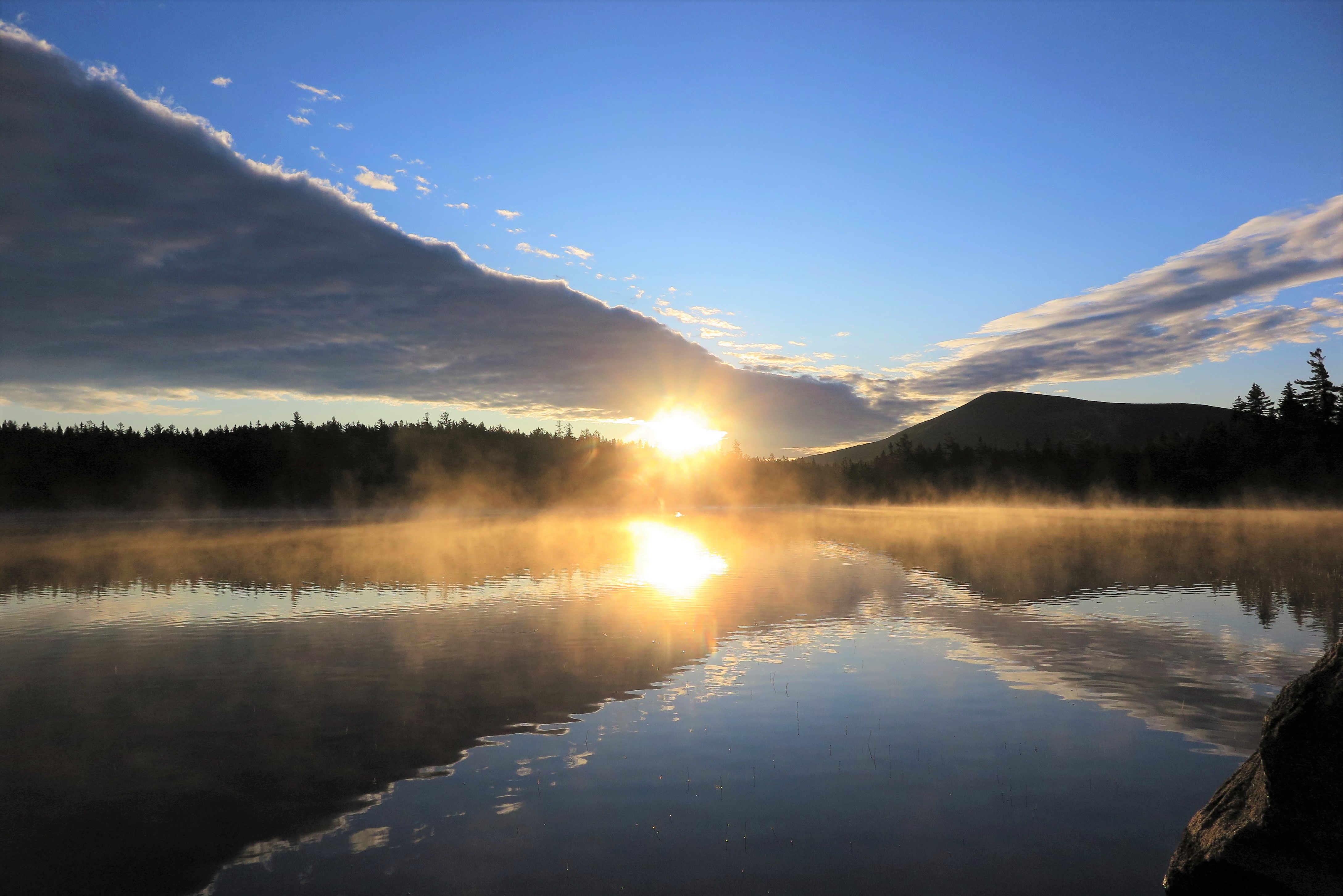
As the sun begins to emerge above the trees directly across the pond from me, I’m lured back down to the shore. It was the very definition of tranquility. A mist hovering over the water was shaded a pink-purple hue by the rising sun, and I spot a lone duck materializing from the mist as it swims through the water. But no, there’s another duck, swimming from the opposite direction, coming to meet the other. The pinks and purples lazily start morphing into oranges and yellows as the sun makes its way closer to the horizon, until that moment when the sun begins to shine its first rays over the trees below the clouds, turning the light delicate yellow, and the sky various shades of azure. I’m entranced as I observe this most routine, yet at the same time extraordinary, occurrence.

IMG_0526

Once the sun has fully risen I snap back into the realities of the day, which consists of quite the long and vigorous trek. My original plan had been to hike up – very up – to Davis Pond, which is about two-thirds up Mount Katahdin, sleep at the lean-to there for the night, and the next day hike up the remainder of the mountain and all the way down again via another longer route. A tough climb up to Davis, and a long second day, but at least the long day would be mostly downhill, and so should be manageable. I was a little concerned about my knees holding up for this. There was a time when I never thought I’d be able to make it to Davis Pond or over Katahdin will a full pack, but between getting hiking poles and, more importantly, investing in some good gear to lighten my pack, I was confident, if a bit trepidatious, that I could do this.

The weather gods had other ideas. The forecast called for rain – and lots of it – on the day I was supposed to have my long hike above treeline. I had realized this even before departing from home for the trip, and had resigned myself to the fact that if it was completely miserable – never mind missing out on all the above-treeline views, but 8+ hours in the rain and much of it in highly exposed areas – I might have to simply hike up to Davis Pond and then hike back down again via the same route, and skip going over the mountain. I was pretty bummed about this, but I can’t control the weather, so I had to accept it.

img_0525-e1570589174965.jpg

Until it occurred to me. Wait… why not do the loop in the reverse direction, heading up the long way, above treeline and over the mountain on the first day with forecasted sun, and then the following day when the rain was due make the short if steep trip back down from Davis?! Why not? Well because it would make for a crazy long day that’s why, not only adding extra miles to my longest hiking day of the week-long trip, but doing my long day up and over the mountain instead of mostly just down!

But of course, the weather and my desire for a really cool long hike on a decent day won out over reason in the end, so with the encouragement of Ranger Greg at Russell Pond, who agreed it was the best option given the weather (“It will be quite a long day” he cautions), I decided to make my most difficult day even more challenging – adding a couple more miles on for a total of 12 miles, with an elevation gain of over 4,000 feet, carrying a full pack.

Strangely (stupidly?) I was crazy excited about it. I had suffering from ill-health for the summer and so had not done a full-on full-day adventure-of-a-hike all season, and I was relishing the opportunity to do so. Yes, it would be a challenge, but that was what made it so enticing! Plus, I would get to enjoy my long day above tree-line in the sun with spectacular views instead of in the rain and fog, even if doing so while going UP the mountain instead of down.

An extra bonus that made the idea slightly more palatable was that I could leave a cache of food the fuel on a bear line at Russell Pond, what amounted to 4 pounds – 20% of my total pack weight – for the two night adventure before I’d be passing through the campground again. For me, the difference between a 24 pound pack, which is pushing the edges of comfort for me, and a 20 pound pack, is the difference between “OMG no!” and “Race you to the top!”

IMG_0505

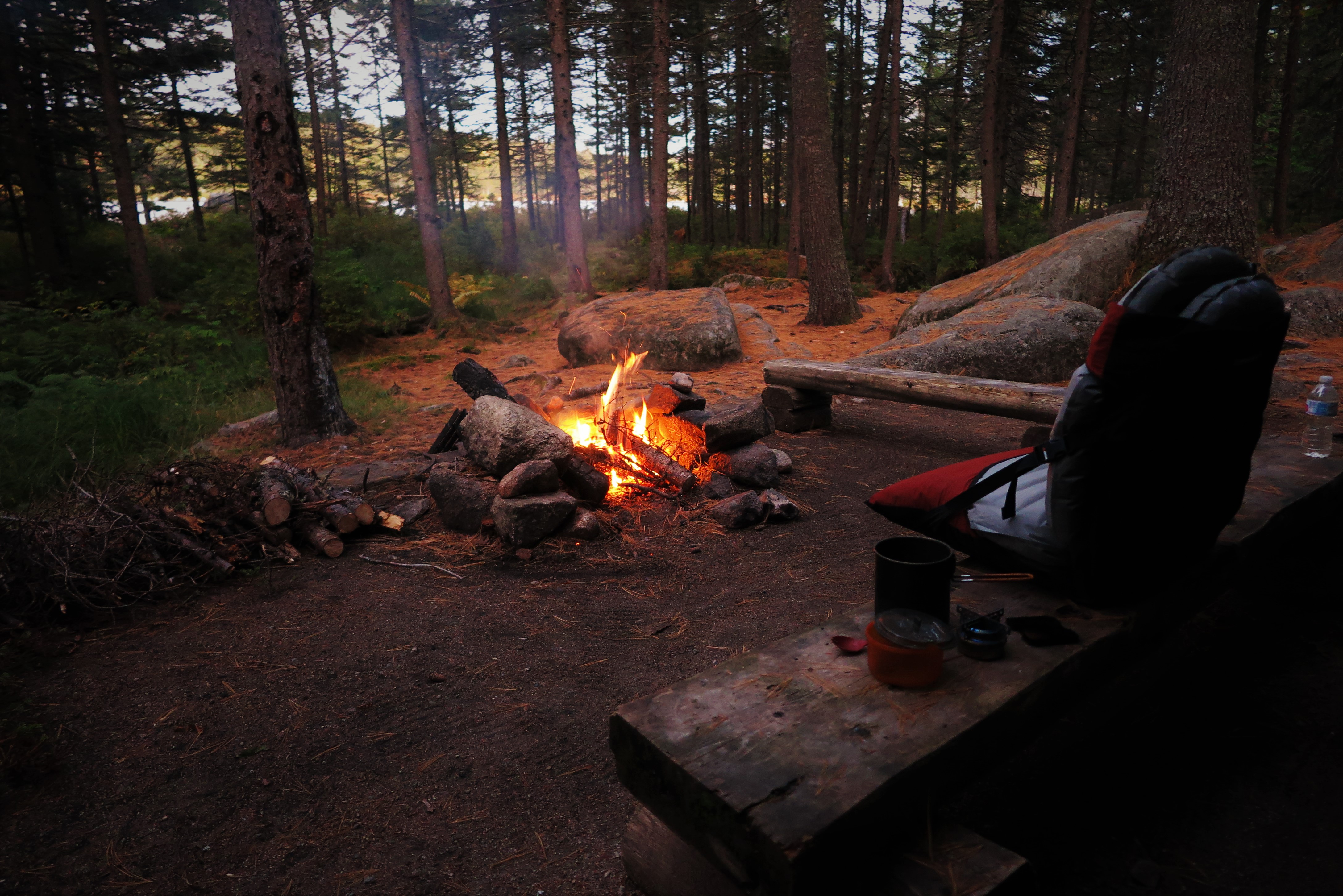
So before dinner the evening before my big day I spent some time sorting through my food stash and separating out the lightest foods that would get me through the next two days, from the rest that I would cache at Russell Pond. I had hauled and sawed up a great supply of firewood that afternoon for the evening’s fire, but even after a whopper of a campfire I still had sawed logs to leave for the next camper, as I turned in early to get a good night’s rest before the next day’s trek.

img_0529.jpg

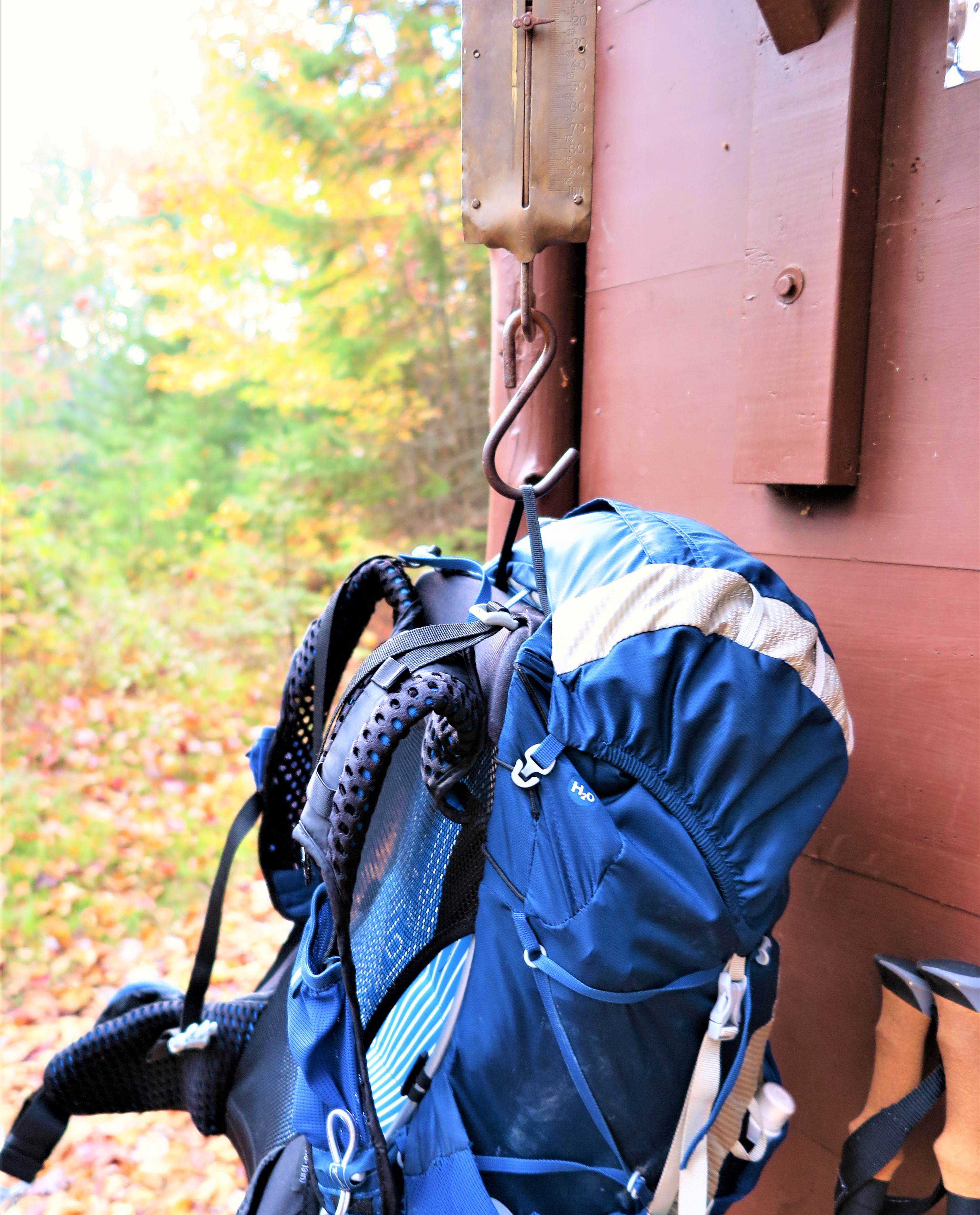
And then there I was, rousing myself in the pre-dawn frigidness for the long day ahead of me. But I was ready, and what’s more I was super excited for it! The beautiful sunrise over the pond may have delayed my departure somewhat, but it got my day off to such a wonderful start. As I left the campground, I weighed my pack – which was feeling much lighter without a good portion of the food and fuel – on a scale to discover it was in fact down to only 20 pounds, which I knew from previous experience was a weight I could haul up tough climbs and over mountain passes, so that just elevated my spirits and confidence all the more.

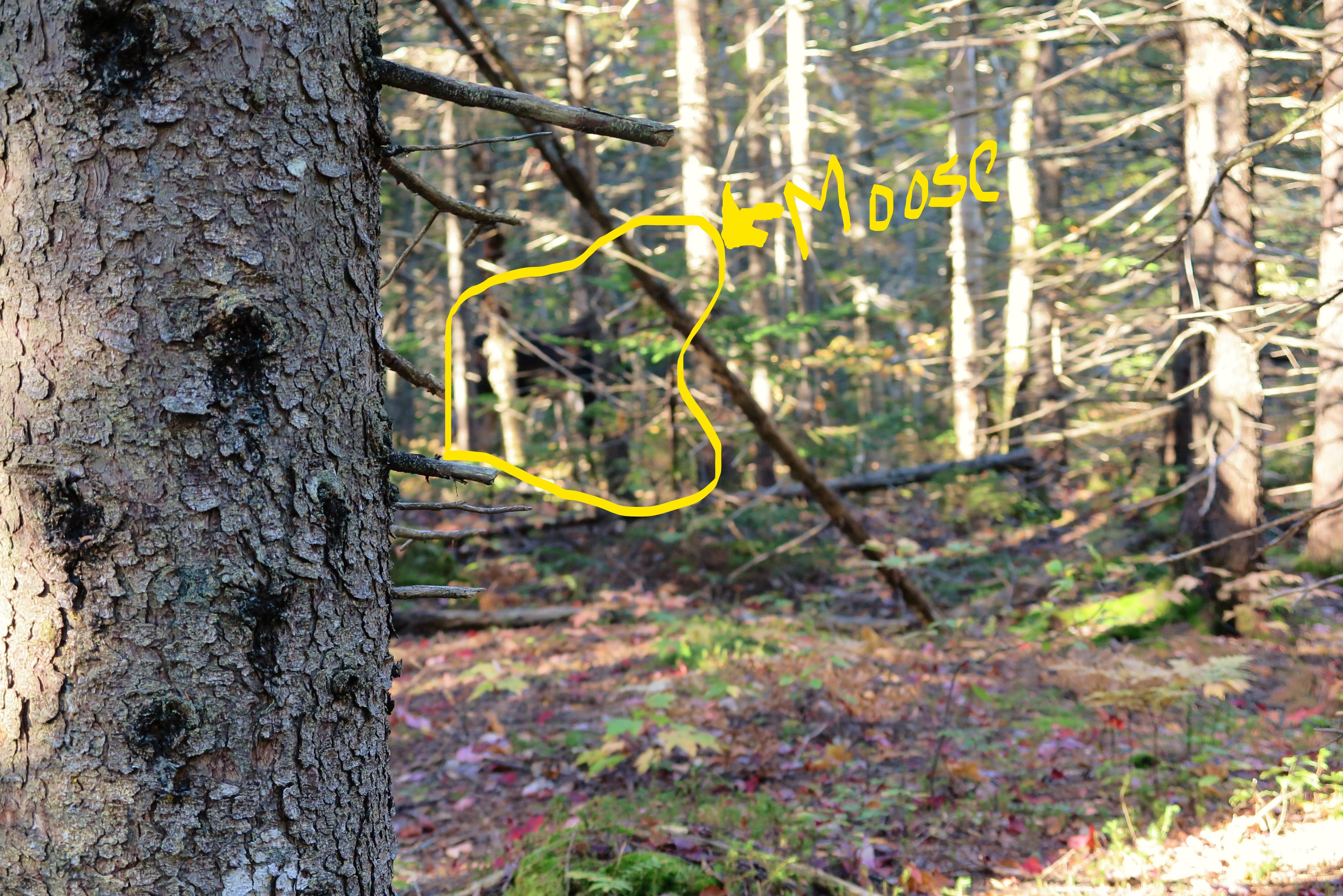
I head out moving along at a fast pace in the early morning chill (temperatures still hovering around freezing) and feeling great. I had gone less than a mile when I heard something in the woods in front of me, off towards the right. Other hikers? I wouldn’t have anticipated others here on the quiet less-used trail at this early hour, but possible. But no, it was not humans I had heard, but moose! Two big beautiful moose not more than 20 feet away from me in the woods. The closer moose was a giant bull, tall and dark and handsome with a full set of antlers. He was quite close, I got a good look at him, though the thick woods made getting a photographic difficult. Compounded by the fact – as a later discovered – that my camera decided to focus on a tree trunk in the foreground of the shot instead of on the moose. So major photo fail, but I had a great view of the moose in person. Instead of trying for a good photo I decided to let the moose be and not bother him, and continued on my way down the trail.

IMG_0535 (3)_LI.jpg

The moose encounter was only a few hundred yards before my first crossing (of three) of Wassataquiok Stream. I knew it was coming, but when I saw what I had to cross I felt my apprehension rising. This was no lazy river, but raging rapids that I had to navigate. After scoping out a hopefully doable route, off come not only the boots and socks, but pants as well, as it seemed I might being going in thigh-deep and didn’t want to get the gear wet this early in the day in this cold weather.

I scoped it out and determined upon a route that seemed the lesser of evils. I was apprehensive, but it had to be done.

Encountering rapids in your path, there’s not much to be done but to take off your pants, determine the best route, and start at it.

That first step into the cold water was rough, but in I went. I went only a few steps before I placed a hiking pole down in front of me to check the depth, and down it went all the way to the handle. Retreat! So I pattered around in bare feet and bare legs rock-hopping around looking for another option. I found route that looked likely, if I could manage the rapid current between two rocks and another in the middle of the stream. I got to that point easily enough, and then very carefully stepped onto that rock in the fast current, which to my relief was only maybe a bit over knee-deep. I got my poles into position with one hand, and my other hand to the rock in front of me, which allowed me to scoot my feet through the raging current and my butt onto the further rock. After managing to swing my feet around without toppling off my perch on the rock, it was essentially smooth sailing from there. I was glad to be across with no mishaps!

I was so focused on getting across the river I didn’t get any photos. But this image EXACTLY captures how I felt on standing on that rock in the current in the middle of the stream, giving myself encouragement in my head (actually I think I was muttering out loud) – “You’re OK, you can do it, you got this!”

As I dried off and redressed, I couldn’t help think that here it was but barely 9AM, and I had already enjoyed a spectacular sunrise over the pond, encountered moose, and successfully navigated a difficult stream crossing. This was going to be an amazing day!

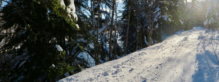
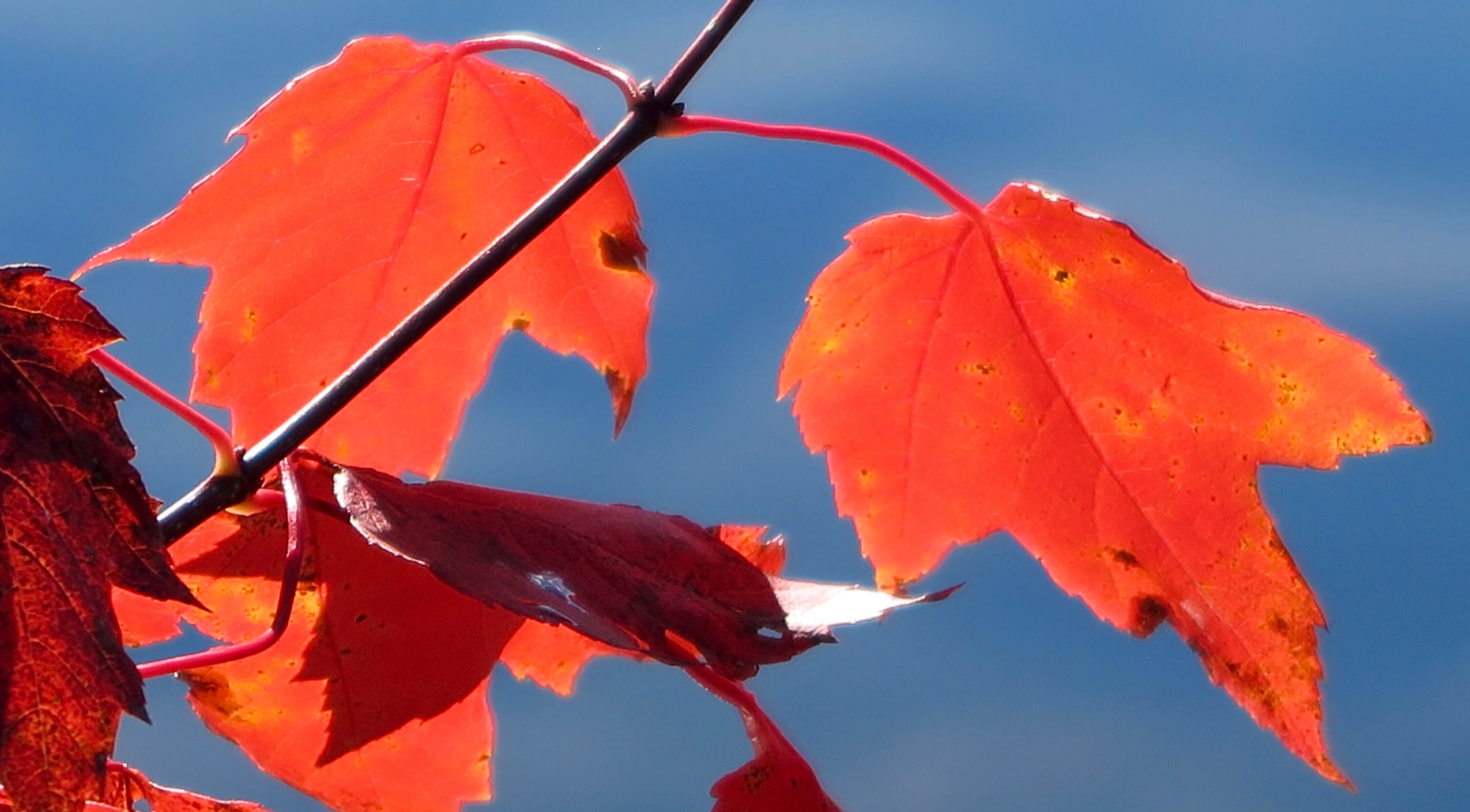
Clouds had come in while I managed my way over the stream, but the trail through the woods was quite pretty, with the dark spruce contrasting with the bright bursts of color from the maples, birch, and aspen. The trail got steep! I had anticipated this, but luckily the severly steep sections were broken up by just very steep sections, providing some measure of relief. It was tough going, but I enjoyed the autumness of it all, even as I was suffering just a bit.

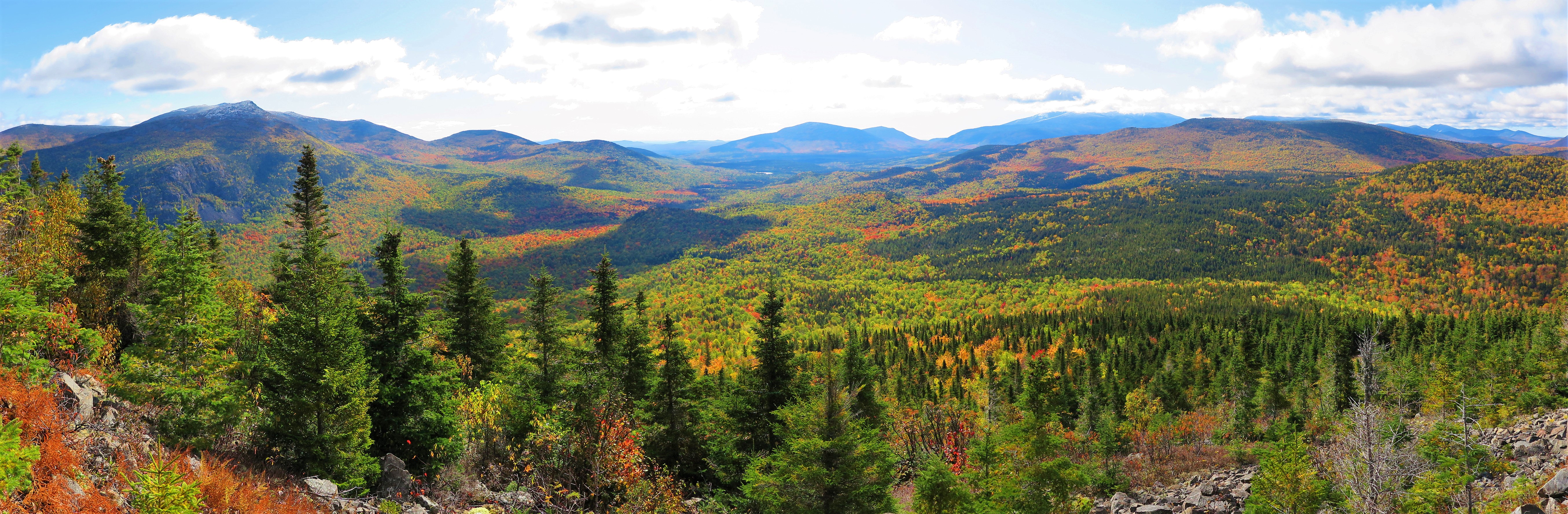
I of course did – gloriously – make it up to treeline, my intermediate destination and designated “breakfast” stop, at the first small peak. It was an interesting view in that it was a different perspective than I had encountered before, but I could see many of the places I had previously visited. By the time I had admired the view and studied the map to confirm what I was looking at, I was getting chilled and wanted to be moving again, so I didn’t make much progress on my snacks before setting out again.

It was quite intimidating looking up and over from this location at the North Peaks that I had yet to summit and cross! But that was my route so I set off to cross them. The most challenging section was reaching the southerly of the North Peaks. Talus fields, giant rocks to scale, and all quite a steep climb UP! So it was all the more spectacular when approached what I assumed was a false summit, when there, between a rock on the right and a giant cairn on the left, appeared Katahdin’s Knife Edge like magic over the peak.

From then on, it was smooth sailing, and utterly amazing. The sun had reappeared by then as well, and remained shining the rest of the day. Not only was the second North Peak and Hamlin Peak no big deal to ascend from there, but I had the view of Hamlin Ridge off to my left, with the Knife Edge and Pamola and Baxter Peaks with the bowl and ridges just beyond rising behind Hamlin Ridge, and the plateaus and tablelands stretched out before me into the distance.

Once at Hamlin Peak, I continued down Hamlin Ridge until I found a lunch/snack/rest spot that was just right. I was at the north edge of the ridge with the north bowl below me on the left, and the North Peaks I had ascended that morning across the bowl. To my right was the main part of Katahdin, with the Knife Edge stretched between its two peaks. Just below me on the ridge were some unidentified pigeon-like birds hopping around and peeping to keep me entertained.

With the sun out and little wind, I was quite comfortable, and it was only a large group of loud day hikers that eventually encouraged me to be on my way. After a day of not seeing another soul, this rubbing up in near proximity to “civilization” in the form of day hikers blathering away and pulling out cell phones (which are not allowed in Baxter for good reason) was as much as a brush with my human brethren as I had need for, and while I enjoyed my extended time on Hamlin Peak I eagerly left it to get back onto the more off-the-beaten-path trails.

The (relatively speaking) off-the-beaten-path trail was the Northwest Basin Trail. In the past when I had hiked Katahdin, I was always intrigued by the northwest basin & plateau, but it requires an overnight with climbing a significant elevation to reach it, and with the knee-trouble I’d suffered from, I never thought I’d be able to go over the mountain with a full pack. Davis Pond the the Northwest Basin remained elusive no-goes for me, couldn’t be done. But… never say never! After substantially reducing my base pack weight and getting hiking poles, I had made it over a considerable mountain pass on the Chilkoot Trail the previous season, on the border between Alaska and Yukon Territory, Canada. If I could handle that, I could certainly get up Katahdin with a full pack!

So it was thrilling and wonderfully satisfy on this trip to actually to take that turn at that trail junction and head off to the northwest basin at last, which was everything I could have imagined and more. It was mid-afternoon by this time, which in Maine in October means a low slant of light, giving a golden glow to the grasses covering the plateau, studded with clumps of stunted spruce and punctuated by glacial erratics, surrounded by mountains in every direction in the distance.

I knew I had a challenge before me when I left the plateau and began the descent into the bowl for the last mile of the day. I was prepared for the crazy steep scramble down, but I hadn’t realized I would effectively be traversing down the middle of a stream! “Wet” the ranger described this trail… I’ll say! And what’s more, there were big rocks to climb over and slide down, washouts under tree roots to tumble over; just an incredibly difficult trail, and all this while dropping in elevation at an alarming rate, wet and slippery, at the end of a long day.

This last mile was extremely slow going, and mentally I was done. If it had been an even, level trail, I could have pushed through physically. Yes my legs were tired and my energy low, but it was the mental challenge that was pushing at the edges of my sanity at this point. It was with immense relief that I arrived down to Davis Pond and the lean-to at long last.

I was pleased I had made it in time to catch the last of the sun lighting up the cliffs around the pond. I found a spot to sit near its shore to watch the shadows slowly making their way up the cliffs, a waterfall pouring down high up near the ridge, and a beaver swimming and slapping his tail in the pond below me.

But I have to admit, my heart wasn’t quite in it. The lean-to location itself was something of a disappointment, definitely more of transient place to crash for the night than a camp at which to hang out, and no real good place to perch by the pond itself, which was out of sight from the lean-to. With the sun going down and me covered in dried sweat after a day of exertion, I was getting chilled fast, so I did the best I could to remove a layer of stink via a frigid sponge bath, and retreated to the lean-to for an early dinner.

But I got stuck. Mentally stuck. I knew my spirits were flagging because, on top of a tiring day, I was so entranced by my surroundings all day that making sure I got some food into me had taken a back seat to everything else, and I realized that I had actually eaten very little all day (which says much about the wondrousness of those surroundings, as usually food is my top priority!)

I knew I needed some hot food to cheer and warm me as I continued to become increasingly chilled. Yet still, I sat and watched the gathering dark for a while, unable to motivate to simply heat up water, before I finally dug down for the force of will to get my stove lit, dig out the dried soup and dried veggies to add, and get some sustenance in me.

And, for the most part, the soup did the trick. I called it a day after the soup – a magnificent, majestic, magical day – and cozied up in my bag. As I drifted off, I was able to fully enjoy sleeping up at that high elevation with the cliffs of the mountain peaks topping out just above me, the sounds of the waterfall tumbling down the cliffs and the wind whistling its way around them, with the only company for many miles around being the squirrels and the beaver and the moose and other four-footed folk.

The following morning I awoke to rain, but it had subsided to simply fog by the time I was ready to depart. The hike down began through unexpected boggy areas in the bowl, with the ground dropping away on one side to the cliffs across the way, and it felt like a world of nymphs and spirits in the blowing fog.

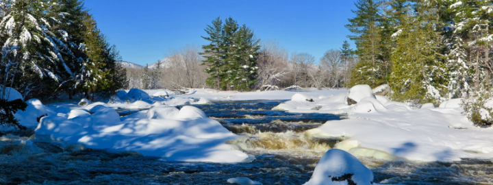
I encountered my next crossing of Wassataquiok Stream right about when I was expecting it. While it did cross rapids, there was a clear route across that was much easier than the crossing the previous day, and this time I took plenty of photos once on the other side.

After the crossing the trail following Wassataquiok Stream, which dropped quite fast in this section, over giant-sized boulders. The trail navigated some of these giant boulders as well, through a dark spruce forest, it was all quite enchanting.

Beautiful though it was, I can’t say I was entirely sorry when the trail flattened out into an even, gentle-grade, path, strewn with the bright colored leaves of the hardwood forest I had entered. For the first time in two days, all I had to do was simply WALK!

Instead of heading back to Russell Pond, the campground at which I had begun this little adventure-within-an-adventure, when I had initially planned the trip I decided I would make the effort to go a bit further and spend the night at a lone lean-to on the banks of the Wassataquiok before returning to Russell Pond the following night. This route took me through New City, where there was a logging camp at one point in time, remnants of which can still be seen. It also happens to be a remarkably pretty and enjoyable section of trail!

To reach my lean-to for the night, I had to cross the Wassataquiok one more time – but this time, while there was a current, it was over a smooth if rocky bottom, so no rapids to navigate. Plus, I could see my lean-to humbly waiting for me on the far side of the bend in the stream. This made it ever-so-slightly easier to take that first step into the cold water, after once again ditching both boots and pants. It was an easy crossing, but I had accidentally taken myself across through a dip in the stream bottom, ending up in the water up to my hips! Whoops! But hey at least I was half-bathed for the day!

Upon reaching the far bank, with the lean-to just around the corner, I didn’t bother putting my boots and pants back on over wet undergarments, but instead walked barefoot and bare-legged – in the windy, cloudy, 40 degree day – around to the lean-to. When I got there I was overwhelmed by how magnificent it was! Typically in Baxter the lean-tos are placed a bit away from the water source by which they are located, to lessen their impact. But at Wass Stream, the lean-to was right on the bank, overlooking the bend in the river with the mountains rising up beyond, the bright autumn colors blazing among the leftover fog still swirling around.

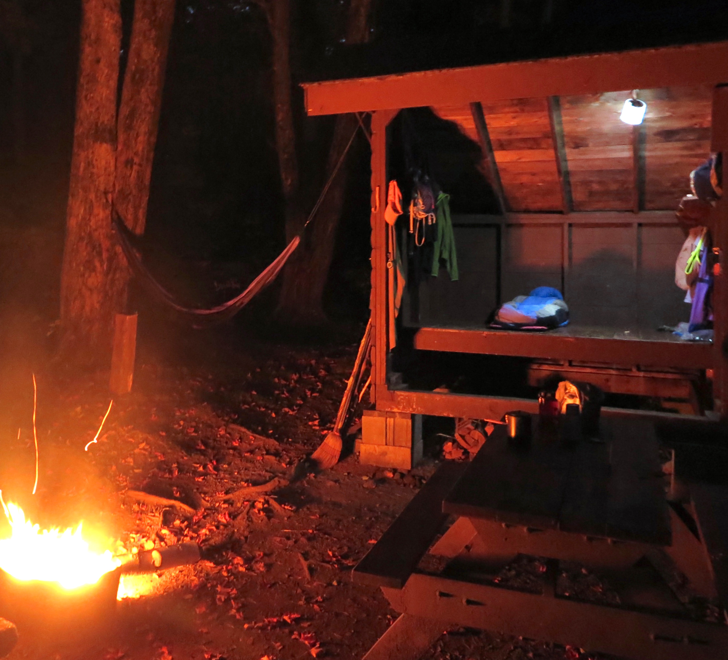
I was so overcome by the overall beauty, as well as the remarkably sweet lean-to location, that I was running around taking photos and exploring the area for a while before it occurred to me to put my pants and boots back on! (Remember, 40 degrees.) An added bonus was when I found the motherload of downed trees for firewood. After spending a good hour and a half hauling and sawing wood, I immediately got a fire started and kept it going throughout the afternoon and evening until I went to bed.

So another pretty fantastic day. This adventure couldn’t get any better, right? But wait! The next morning, I awoke to an “oomphing” sound early in the morning. I open my eyes to see a bull moose lumbering his way across the stream (where I had crossed the previous afternoon). And I didn’t even have to get out of my sleeping bag in the lean-to to see it!

This (quite lengthy) narrative is only one and a half days of an eight day trip in the backcountry. Tranquil ponds, raging stream crossings, mountain peaks, autumnal woods; moose, beaver, spruce grouse; rain, snow, hail, wind squalls, frigid temps, but plenty of sunshine too. It would take a book to relate the entirety of the experience, and how meaningful it was.

There were challenges for sure – both physical and mental, not to mention the difficulty of simply staying warm when I wasn’t hiking. I was out there entirely by myself; more often than not the closest other person would be many miles away at best. I had only myself to depend upon, and as such it would become apparent rather quickly when I faced these challenges what I could deal with easily, and what I struggled with. But each challenge that presented itself I met head on and overcame, which made the highs of the trip all the sweeter.

I travel around the world, but I’m not sure I’ll ever find a place quite as special as this one practically in my backyard (relatively speaking.) I never cease to find the intricacies of the mountain fascinating, and revel in the more out of the way locations where I go for days without seeing another soul. Thank you Percival Baxter for your foresight. I am forever grateful that I am able to immerse myself in this environment from time to time; I find the restorative power it has for me is immeasurable.

IMG_0759 - IMG_0761.jpg

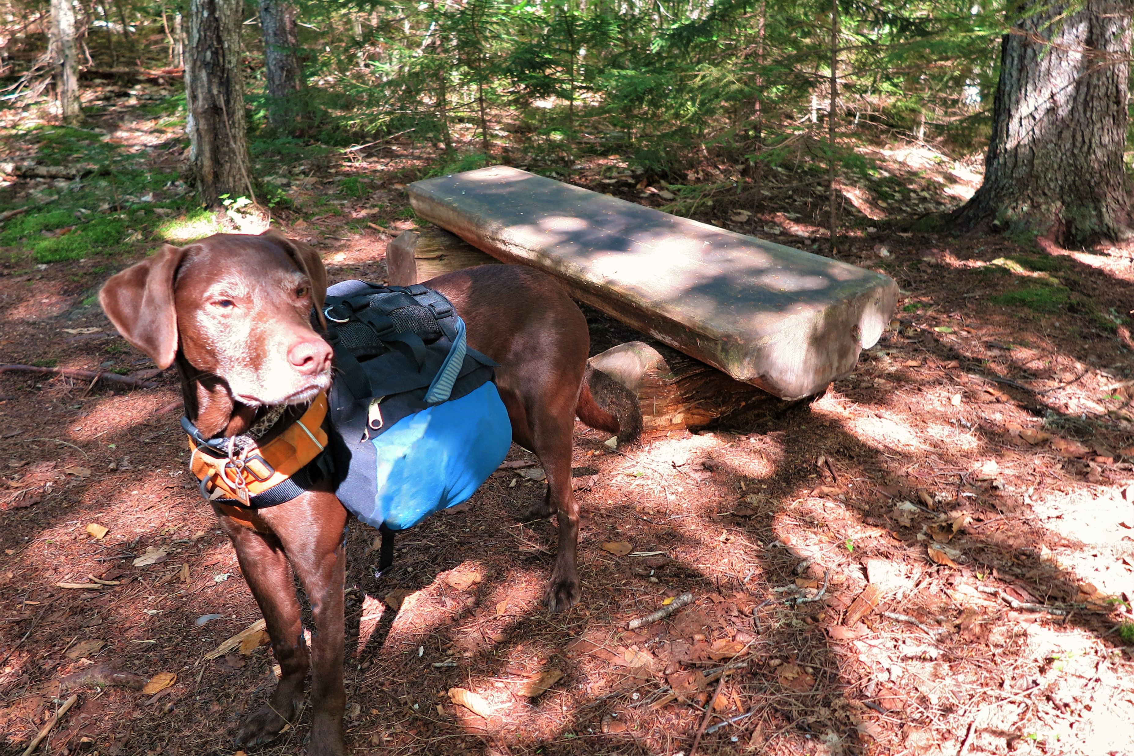
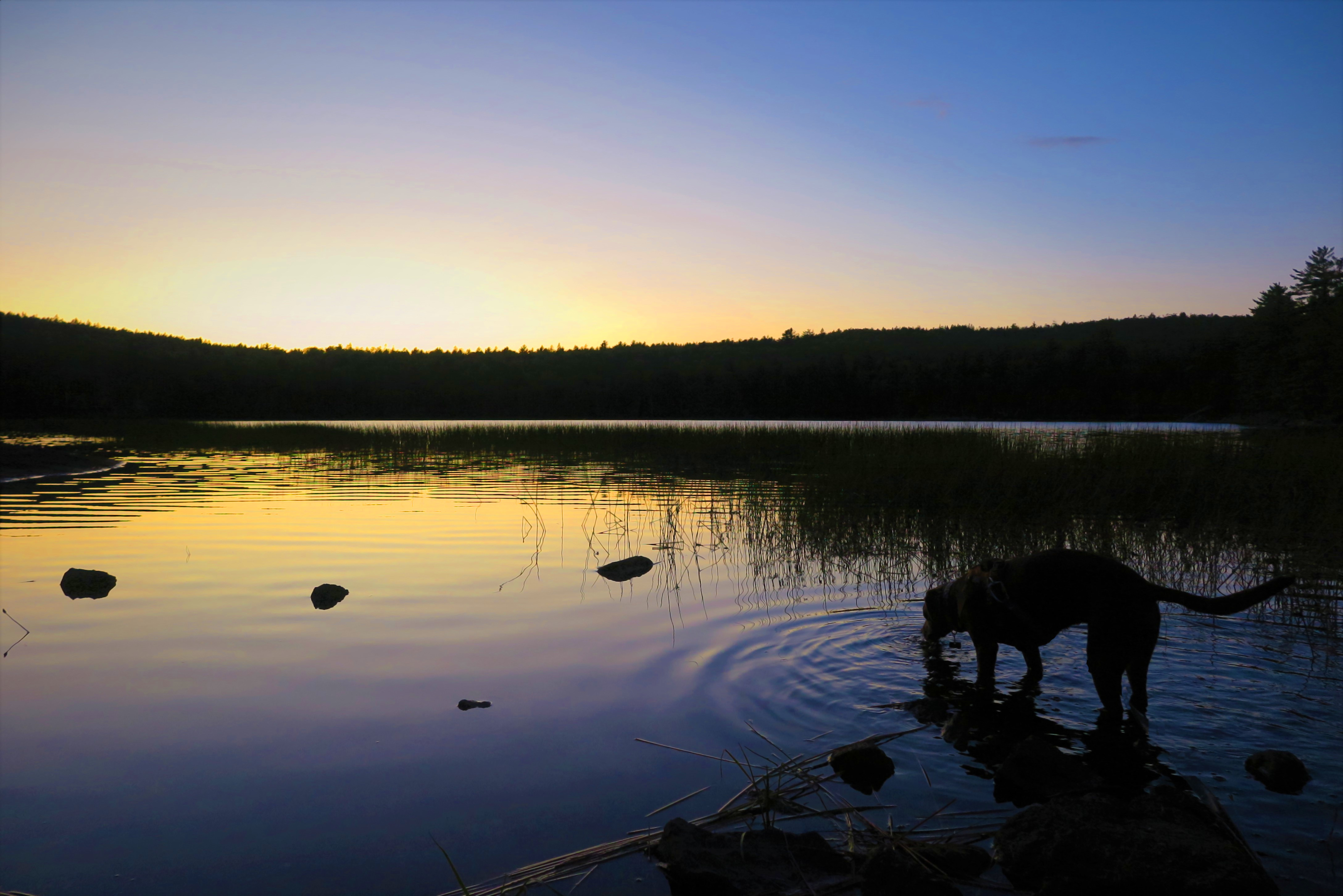
It makes is so hard to return to civilization, the so called “real world.” I will never forget the time Ranger Gabe at South Branch wished me “Good luck with your re-entry” as I was driving off. He gets it! At least upon returning home I could cuddle up with my warm dog under lots of blankets. But I think – I hope – there is a part of me that never entirely “re-enters,” a part of me that always remains drifting on a pond, crossing rivers, feeling small amid mountain peaks, and yet at the same time fully connected to, and a part of, the wondrous sights, sounds, smells, tastes, and feel of all by which I am surrounded. I will consider my life well-lived when I have learned to take how I experience the wilds of our world, and carry that into to my daily life, allowing me to genuinely engage with all that is around me, and live more fully, meaningfully, and deeply.

It’s been a pleasure Baxter State Park, see you next year.Hope Rowan is the author of Ten Days in Acadia: A Kid’s Hiking Guide to Mount Desert Island, published by Islandport Press in 2017, as well as Ten Day in the North Woods: A Kid’s Hiking Guide to the Katahdin Region, published this past May. When not exploring the wilds of her beloved state or further afield, she resides in Southwest Harbor, Maine.


View Interactive Map

Baxter2019-RouteGreen=Described Route, Orange=Rest of Trip

Trail “Tails” – Trekking with Tess

After travelling every weekend last summer for research (A.K.A. hiking and camping!) for my 10 Days in the North Woods hiking guide, I wanted to stick around and enjoy home more this summer. Add on some health issues I’ve faced of late, and come September I realized I hadn’t camped out at all since June!

I was getting the itch. I have enjoyed my time at home and getting out into Acadia National Park in my backyard, but as glorious as Acadia is it’s nice to explore new trails. And, yes I have a backpacking trip to Baxter State Park in just two weeks, but two weeks was feeling like WAY too long to wait.

So on a recent afternoon, with some splendid cool, dry weather due the next day, I spontaneously decided to check out some trails and a camping spot I had had my eye on. Acadia National Park, Baxter State Park, and many of the well-known trails in Maine like Tumbledown, Bigelow, and Gulf Hagas are certainly nice and quite dramatic; but I was on a quest to explore some of the many, many lessor-known preserves and trails that pepper the State of Maine.

The Amherst Community Forest was the perfect location for a quick get-away, when I felt the need for a night under the moon and stars. Just an hour drive to the north, and only a half mile from the trailhead to the primitive campsite on the shore of Ducktail Pond.

Finding a dog-sitter only a couple hours before departing was unlikely, so my energetic pup Tess was along for the trip. She hikes with me regularly, and has car-camped and done a canoe trip with me in the past. It had been a while – I didn’t think through WHY it had been a while – but I was only heading out for one night so no big deal, it would be fun to have her along.

TrekWTess_Amherst_Sep2019_14
All geared up and ready to go!

I finished up work for the day a bit early, managed to get food prepared and gear packed in just over an hour, and hit the road. I found the trailhead without too much trouble, donned my pack, and got Tess set up with her very own pack. She carried her own food in, as well as a bottle of beer for me – good dog!


With only a half mile to hike in to the campsite, it was a little bizarre heading out and then reaching my destination in just ten minutes. We were just getting going! But it was just as well; in these days of waning sunlight, we reached Ducktail Pond as the sun was setting. There was just enough light left for me to set up the tent, toss a line in a tree limb for my food bag (got the line over on the first try, go me!), and gather and saw wood before it was totally dark.

TrekWTess_Amherst_Sep2019_02
Dusk at Ducktail Pond

As I a got the fire going – it took a while, recent rains meant damp wood that did NOT want to burn, but I prevailed! – I could see the moon rising through the trees. Coincidentally it was a full moon that night, and it was beautiful.

I enjoyed my dinner and the stout Tess had hauled in for me in front of the – hard won  -fire, under the light of the full moon. However, it was difficult to relax entirely, as Tess was wondering when we were going to keep going on our hike and return home. The initial whining and crying whenever I moved away from her by this point had faded into sitting and staring at me, “It’s time to go mom, c’mon!” Despite the destruction caused – she has no sense of “Leave No Trace” apparently – it was nice break when she would occupy herself by digging at tree roots. But mostly she was whining or sitting and staring at me, she was not having fun. Not once all evening did she lie down and settle in. Ugh.

TrekWTess_Amherst_Sep2019_05
Dog butt. Luckily she spent most of the night not like this, but curled up in the bottom of the bag, or with her head where her butt is in this photo.

I should have foreseen this based on past experiences, but I guess I had willfully blocked it out. What I HAD foreseen was the camping equivalent of her insisting on sleeping under the covers in my bed. Sure enough, as soon as we got in the tent, she was quite forceful about getting in the sleeping bag with me, and there she remained through the night.


Lucky for me, she was not squirming, and only rearranged her position a couple times during the course of the night. And, she kept me nice and warm, even if it was a bit crowded! With the tent’s fly left off knowing it would be a dry night, there was only a screen above me, and I headed off to sleep under the light of the full moon, now risen fully above the trees, and with a gentle breezes blowing through the trees and caressing my face. It was perfectly lovely, my heart was content.

TrekWTess_Amherst_Sep2019_06


TrekWTess_Amherst_Sep2019_08

Next morning, after some strong coffee, we took the trail over to Partridge Pond for some exploring before packing back out.

With only a couple of miles of trails in this area and a perfectly beautiful day still before us, we stopped to explore another lesser-know set of trails on the way home. Long Ledges and Baker Hill, owned and managed by the Frenchman Bay Conservancy. While these may not have been the mountain peaks of Acadia, the trails were well-maintained and well marked, and more to the point were exceedingly pleasant passing through spruce forests, and along granite ridges covered with lichen interspersed with red pine.


LongLedges

I should note – that while the hoards were making their way parade-like along the trails in Acadia, I never saw another soul at either the Amherst Community Forest or at Long Ledges and Baker Hill!

TrekWTess_IceCream_Sep2019
You’re supposed to lick it not bite it Tess!

On the way home, a stop at the Blueberry Hill Dairy Bar was called for, to get Tess a Doggie Bowl (vanilla soft serve sprinkled with dog biscuits) to make up for her trials over the past 24 hours. We were back home in time for me to get in an afternoon of work and finish some things that needed finishing before the weekend.


I was glad I had motivated at the end of the previous day when it would have been so easy to just stay home. I had a mini-adventure, a beautiful night camping out under the full moon, and got to explore some lesser-known and less-populated trails that were just delightful. It has inspired me to explore some of the other “hidden” campsites and sometimes obscure, but almost always wonderful, small trails that are just waiting for my discovery in the forests all around me. Next time however, as much as I love her, I think I leave the dog behind!

If you would like to discover some of the less-famous trails and preserves in your neck of the woods, your best bet is to contact your local or regional land trust. If you don’t know who that is, you can find a listing of land trusts in Maine here. Or, check out Maine Trail Finder for maps and trail descriptions of almost 1,000 trails across the State of Maine.

Projection: Cylindrical (1) FOV: 110 x 68 Ev: 13.65


XC Ski to Haskell Hut, Katahdin Woods & Waters National Monument

I love winter. More precisely, I love snow – winter without snow? Blech, who needs it! Tired of the lack of snow here on the Maine coast, one recent evening I spontaneously (highly uncharacteristic; I am not a spontaneous person) decided to head a couple hours north to ski into a hut and spend a night in the middle of the Katahdin Woods and Waters National Monument. By 9 AM next morning, I had determined the huts are in fact available for use in winter, secured my hut reservation, an overnight parking pass for KWW, and dog-care at the wonderful Katahdin Kritters for my furry friend Tess. So what that it was forecast to be the coldest night and weekend of the winter yet, with below zero temperatures, I’m a New England girl I can handle it! I dug out my back-backing gear from storage, put TWO sleeping bags in my pack not being sure exactly what “hut” in this instance would consist of, and off I went!

It’s a bit of a haul to get to the north end of the Monument from my home on Mount Desert Island, and I had a meeting on the way, so it was 2:20 in the afternoon before I reached the gate where I’d leave my car and set out on my skis – sadly at this time of year only 2 hours before sunset. But no problem – I had anticipated the late start, and it was plenty of time to ski the 6 plus miles (via the Old River Road trail along the Penobscot River) to Haskell Hut. Even if I lingered too long taking photos and didn’t make it before sunset, I had lots of warm gear and a good headlamp – not to mention a beautifully clear sky that would no doubt offer multitudes of starlight under which to ski – so while I preferred to arrive to a new place in the daylight to check it all out, I wasn’t concerned about darkness coming before I reached the hut.

oldriverroad-720x270

The first stretch of trail, on the Old River Road, followed the banks of the Penobscot River. It was relatively flat and easy going, and with the trees heaped with fresh snow, and the dazzling sunlight illuminating the snowy trail as well as the water smoothly flowing by, I was in winter-wonderland-heaven. After about 2.25 miles, I came to a marsh on my right and crossed a small bridge where the marsh emptied into the river. The marsh afforded a beautiful view across to the ridge of a Bald Mountain. Alongside the open marsh, there was nothing to hinder the wind, but I braved chilled fingers to take off my giant mittens and snap some photos all the same! Just past the marsh, I came to the Oxbow Road, which took me right back up to the main trail (Messer Pond – Orin Falls Road).

From this point to Haskell Gate, I went up and down some gentle grades surrounded by the bare-leafed branches of deciduous trees. By now the sun was quite low in the sky, well hidden by the mountains, with dusk settling upon the landscape. The stark silhouettes of the tall trees and sharp angles of the branches were all the more emphasized by the purple sky glowing behind them. The patterns of the trees in the darkening dusk, the ever-changing light, the chill air stinging my exposed face (I had long before ditched the face mask I started with), the shusch-shusch-shusch rhythm of my skis sliding across the snow the only sound insinuating itself into the silent evening – I was totally absorbed by being in that place, in that time. Anything seemed imaginable. Lingering in the past holds one down; worrying about the future hems one in; but just BE in the present moment, and the world is suddenly full of promise and possibilities. Pure magic.

dusk-720x270

Past Haskell Gate, the trail took a bend downhill into a spruce forest, the spruce boughs heaped thickly with the recent snow delighted me. This was the final stretch before reaching the hut, to which I did arrive before it was entirely dark, though sunset was well past. While I liked the idea of skiing by starlight on such a clear evening, I was glad to reach the hut, new to me, before dark, so that I could take a look around and get my bearings. And make sure I knew the location of the outhouse (took me a bit to find it, even in the lingering light!)

When I decided to do this trip, I wasn’t sure what I would find as to my accommodations and exactly what sort of a hut this would be! But I was pleasantly surprised by how substantial Haskell Hut was – not necessarily in size, spacious enough but cozy too, sleeping eight – but well-enclosed, well-provisioned with cooking pots and pans and dishes, and games, books, and puzzles – and a rocking chair!

And, most importantly, quite the workhorse of a wood stove. As soon as I arrived – after finding the outhouse and snapping a few photos as well – my priority was getting a fire going before I cooled down too much from my ski. I huddled in front of the wood stove and worked on thawing out my toes while the temperature inside the hut began its slow climb out of the single digits. It took about an hour before it was comfortable enough – standing in front of the fire – to change out of my sweaty ski clothes, and start melting snow and heating water for my dinner. By the time I ate my dinner, I had to move the rocking chair well back from the fire and take off my hat; by the time I went to sleep, it was almost TOO hot in the hut! Frankly, I was much warmer in the hut than I would have been at home in my drafty house, with the not-so-great wood stove with which I heat it.

Haskell Hut in the morning light

Next morning I woke in the early hours of dawn; I could have laid there forever savoring the reflective light of the not-yet-risen sun lighting the sky over Haskell Deadwater and shining its way around the trees in through the windows. But I wanted to see the sunrise properly! So, still ensconced in my sleeping bag, I threw on some boots, hat, and mittens, grabbed my camera, and headed out into the chilly morning. It was magnificent! Minus eight degrees according to the thermometer, but I was relishing the wintry air. It was so still and serene – not a breath of wind, nor a murmur of sound to be heard. I spent a good half hour watching the sun emerge and slowly light the treetops, the hut, and finally the snow beneath me.

A re-warming by the stove, hot coffee, and some dried fruit and nuts were called for before heading back out for a morning ski. I made my way down the main trail to explore further along to the south. I found Haskell Rock Pitch, three-quarters of a mile down, and enjoyed the sight I’m much more familiar with in the summer, of the cascading falls of a river. I continued another mile and a half or so, completely reveling in the brilliant sunshine and utter snowiness of my surroundings. It seemed like mere seconds before my designated turn-around time forced me to head back to the hut.

haskellrockpitch-720x270.png

When I saw the hut come into view perched atop the bank of the Haskell Deadwater, it felt like a homecoming of sorts even after just a single night there. I revived the coals of the fire to make some hot chocolate, giving myself some time to linger just a bit more. But reality was rearing its ugly head, and I needed to be off. I refilled the wood I had used from the woodshed, swept up, and said my goodbyes.

By this time, temperatures had warmed to the balmy low teens, so I ditched one of my layers from the day before and the morning, and set back out to the north. I couldn’t resist going the extra mile and a half to go back by way of the river again. When I reached that stretch, a small breeze afforded by the river’s proximity had both brought down quite a bit of debris to ski over, and completely obliterated the groomed trail with drifts, though the drifts were hard-packed enough to easily ski over. That wind, however, was just enough to send those cold temperatures right through my now-reduced layers of gear, resulting in my not being entirely sad when I reached my car! Plus, after not skiing all winter due to a lack of snow at home, 16 miles in two days, with a fully-loaded pack, had taken its toll on my quadriceps. Always hard to get back into the car and head back to the “real world” even after just a short time in the wilderness, but boy was I tired out!

I had departed the previous day at 2:20 and strangely returned to my car at exactly 2:20 to the minute the following afternoon. Such a short time really, but so huge in its significance. And to think, I could have – and almost – stayed home, sitting around avoiding the cold, and doing chores around the house. Instead, I made a tiny bit of effort, and had the most wondrous and unforgettable experience, enjoying the wintery wilderness of this amazing place that I’m lucky enough to call home.

Travels With Ellie

Between my hiking, running, swimming, kayaking, canoeing, dog-walking, and general explorations, I rarely have the time to add biking to the mix. Living near, but not in, town, I like to use my bike as a means of transportation when possible, but even this I find myself doing less often that I’d like (the large hill up to my house not helping.) So when Crow Athletics, a running club based on Mount Desert Island, shared a promotion for Pedego Acadia that involved commuting to work for week on an electric bicycle, I jumped at the opportunity.

Now if you are a serious bicyclist, you might scoff at an electric bike as “cheating.” But for me, I didn’t see it as something I would use as in place of my regular bike, but instead of an alternative to driving around in my car. Not getting stuck in traffic behind slow tourist? Traveling with the breeze in my face with minimal effort? Reducing carbon emissions? Yes please!

The bike is extremely cool in that I still pedal, but can control how much effort I want to put into it. Coasting along a flat stretch, I can do most of the work myself. I come to a hill, switch up the motor to a higher level, and the electric engine will take over most of the effort to carry me up the hill if I so desire (which, frankly, on most hills I do desire.)

My goal is to not get in my car for the duration while I have the bike (with the exception of getting my dog out to places to walk her off-leash, she has energy she needs to burn, preferably NOT by her pulling me on the bike which could be scary and dangerous!)

DAY ONE

VeggieGarden_Jun2018 - 6

The bike – which I’ve now dubbed Ellie – arrives on Sunday afternoon. With recentdownpours of rain, I hadn’t visited my garden plot at the nearby Kelly Farm Preserve – a community garden owned by Maine Coast Heritage Trust – in over a week, and suspected that while my plants were well watered by the rain, the weeds must be running rampant. It seemed fitting somehow that my first trip on the electric bike should be to go tend to the plants that would soon feed me. So off I go, a little apprehensive, as it felt a little unnatural at first that when I would pedal, the bike would take off much faster than the effort I was putting in deserved.

I quickly discovered the downside of traveling by bike – cars! The cars going by me on my way to Bass Harbor were not that pleasant, and I often felt pushed further onto the narrow pot-hole-ridden shoulders than I wanted to be to ride comfortably, but I had been anticipating this.

I arrived at the community garden in no time, and after an hour of clearing out the weeds and spreading some compost, was ready to hop back on the bike. By the trip home, I felt I had mastered how the bike works. It was such a pleasant, warm, summer-y evening. It reminded me of the bike rides I would take around the neighborhood on summer evenings as a kid. I was fully enjoying the smell of the flowers I was riding by, and the freshly cut grass, and the spruce trees and rugosa roses and seaweed smells along the ocean, and the whiffs of barbecue as well as families started preparing their dinners.

seawallsunrise2_oct2016-10.jpgI was so enjoying it I decided to take the long way home, and add an extra loop on down past Bass Harbor Lighthouse and Seawall, a beautiful stretch along the ocean in Acadia National Park. While twice as long, this had the added benefit of cutting off that stretch of unpleasant road with cars zipping by forcing me into potholes along the side.

I found that I could almost keep up with the cars in many places, maintaining a speed of around 25 mph once I was comfortable with the bike. And going back up the hill to my house, I got a distinct pleasure from just using the throttle and not using the pedals at all while going UP the hill, and past my neighbors around their fire-pit in their front yard. Did they notice I was going uphill without pedaling? Probably not! But I enjoyed it all the same.

Unfortunately, I left the bag of kale I had harvested behind at the garden – but all the more excuse to do the loop again early in the morning to retrieve the kale, and enjoy some more time with Ellie. It may have taken a bit longer than had I gone by car, but instead of returning home stressed from traffic, I had fun in the journey and returned home HAPPY! And in the end, isn’t that the point?

Going it Alone: The Merits of Solo Hiking

On a recent backpacking trip in Baxter State Park, as I checked in with the ranger before heading into the backcountry for the week, the ranger commended me and said how she loved seeing women hiking and camping on their own. I felt so gratified to hear this, as more often than not I get the opposite reaction. Personally, I couldn’t agree more with this ranger, particularly when that woman hiking and camping on her own is me!

MooseRiver_Sep2015-tent
I greatly enjoy hiking solo. Whether it’s a quick hike in Acadia to clear my head after work, a week backpacking in northern Maine, or as a part of a longer trip in a different country, I find adventuring on my own highly satisfying, and an entirely different experience than hiking with others.

Travel in general I find to be a completely difference experience on my own versus with others. One of the aspects about traveling by myself that I enjoy the most is (ironically) all the interesting people I meet. I find when I’m traveling with someone else, not only am I less likely to strike up a conversation with others, but I find it’s highly unlikely other travelers will initiate any exchange with me. I find this is the case wherever I am, whether summiting mountain peaks or exploring world-class cities. When I’m exploring distant locales, I enjoy meeting folks from the world over, both from the place I’m visiting and others touring that location, and I find this occurs much more naturally when I am on my own.

There are immeasurable of benefits to hiking on one’s own. Given the course of a typical day, even when I am home by myself, my mind is occupied by whatever task is at hand – whether I am sitting at the computer focused on work, interacting with screens of any kind, cooking up a new dish, playing an instrument, or reading a book. When I am out hiking alone I can be “one with my thoughts.” It gives me such mental space, and I do my best thinking when I’m hiking – many a personal problem has been solved or idea for work generated during an ascent to a summit. Getting away on our own, away from the dissonance of distractions that plague modern life, gives us room to reflect and get to know ourselves, know our own minds, evaluate our decisions, and discover our desires.

“I am no more lonely than the loon in the pond that laughs so loud, or than Walden Pond itself.” Henry David Thoreau, Solitude

As well, when I am hiking on my own, I can observe my surroundings without distraction. Whether it is a chipmunk chattering at me from a stump, or fall leaves lit by the sun in such a way as to catch my eye. Compared to when I am with someone else, with my attention on the other person and our conversation, causing me to miss so much of all that is occurring just beyond our little bubble of focus on each other.

Baxter2016 - 26

Being an independent person, I have at time been accused of being selfish. One could interpret Emerson’s essay Self-Reliance as espousing a lack of caring about others and society as a whole. Can, and when does, self-reliance become self-ishness?

The most impactful benefit of solo hiking in my opinion (and even more the case when solo backpacking in the wilderness) is that it fosters – in fact necessitates – self-reliance. Whether mentally pushing one’s self those last couple miles to the evening’s campsite, or heaven forbid hiking out on one’s own with an injury, or even just getting out of a cozy sleeping bag in below-freezing weather to get the food bag down from a tree to make a hot cup of coffee! Both mentally and physically there is nobody around to assist. This cultivates a certain mental toughness within us. We become more self-aware, cognizant of our strengths and weaknesses. We become more confident – the more we are able to thrive independently, the more we realize what we are capable of accomplishing. We learn to trust ourselves, our intuition, and how to follow our instincts and plain common sense.

“Speak your latent conviction, and it shall be the universal sense; for the inmost in due time becomes the outmost.” Ralph Waldo EmersonSelf-Reliance

When it comes down to it, while most of us have others in our lives that can lend a helping hand, in the end it is up to each individual to create our own happiness for ourselves from the inside, and by taking that and applying it to what we do with our lives on the outside. To quote Emerson, “Nothing can bring you peace but yourself.”

“BUT IS IT SAFE?”

Isn’t it dangerous? What if something “bad” happens, and no one else is around to help? Well, bad things can happen anytime, anyplace. And even when there are other people around that doesn’t necessarily mean they will help you! As with anything else in life, it is a matter of being the best prepared that you can be, knowing you can’t anticipate every situation that will arise, and most importantly, using your brain and plain old common sense.

Baxter2016-trails
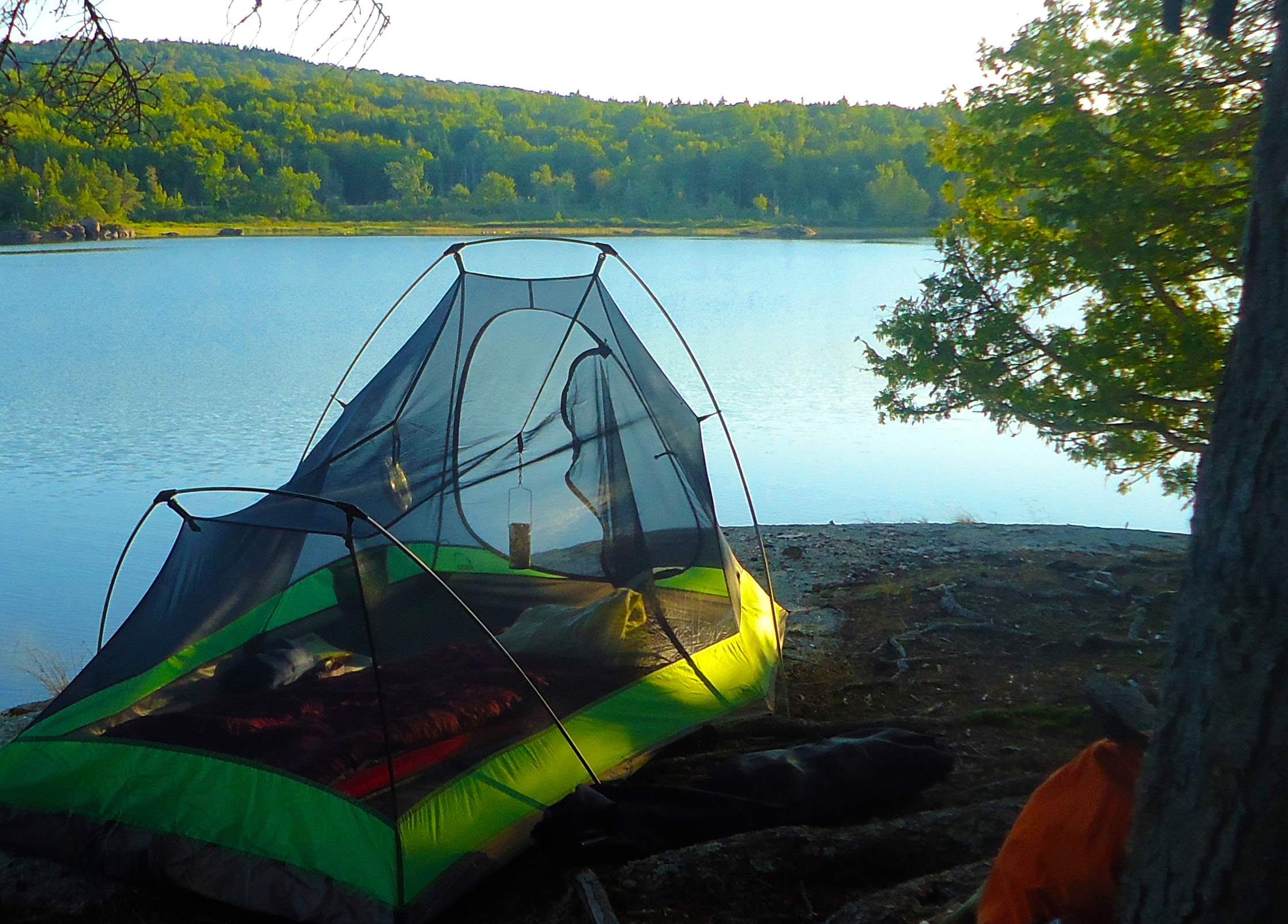
Getting lost. Having others lost with you is really of no help (unless maybe you are lost overnight and have each other’s body warmth to help stay warm.) More to the point, there’s really no reason you should get lost if you a prepared with a map and compass and the skills to use them, and you avoid making stupid choices.

Injuries. Know your pain tolerance! I have managed to hike out with broken bones. If it were a more serious injury and I was in and out of consciousness, this might be more difficult, and this is a risk I acknowledge and knowingly take. But this particular risk can be minimized by not putting yourself in situations where you are more likely to get injured in the first place (staying on the marked trails, etc.)

Crime. The numbers support that public lands are overwhelmingly safer places than the rest of the country. Your risk of being a victim of a violent crime (murder, rape, or aggravated assault) is thousands of times lower in a national park than in the country as a whole.


Crime_PublicLands
source: backpacking.com


Interestingly, the other solo hikers I encounter more often than not are men; I am less likely to see other women hiking by themselves. The Appalachian Mountain Club reports that only one in four hikers on the AT are women, although anecdotal evidence says that the percentage of female through-hikers is on the rise. Ashley Gossens, solo hiker and writer, suggests that “The fear of hiking alone is a cultural thing for [women]. It has been ingrained in us since we were little to never do anything alone. Men don’t really get that.” I have to admit, I find it rather incomprehensible myself, having always been fine doing anything alone since I was young, but while I personally may not fit into that norm, I do think this is in fact a cultural perception for women.

Baxter2016-leanto
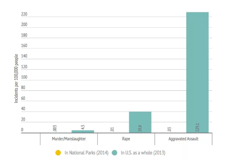
However, this perception is not consistent with the reality of safety for women being out in the backcountry on their own. In addition to crime being practically non-existent in public lands, 82% of sexual assaults are committed by someone known to the woman upon whom assault was committed. Which means that sexual assault upon a woman out exploring public lands by herself is significantly less likely than while that woman is going about her day-to-day life among the people she knows.

Bottom line? There are safety measures to consider when hiking or heading in to the backcounty by yourself, for sure, and these need to be taken seriously. But these are precautions that ANY responsible hiker should take under consideration, whether heading out solo or with companions.

During a book talk for my children’s hiking guide over the summer, I was rather surprised by an attendee asked me at what age it’s OK for a child to hike by themselves. In my hiking guide, I recommend kids hiking with others for safety. But I am for kids heading off on a trail on their own, if they are mature enough for it (regardless of numerical age); if safety measures are in place; and if their parents are comfortable with it and confident in their child’s abilities. Like with an adult, it’s a question of kids knowing what to do and how to handle any situation they may encounter. A plan cannot be made for every possible circumstance, but reviewing plans with the child for say getting hurt, or becoming lost, would be wise; ensuring children have the common sense to apply knowledge to the unanticipated before they hike on their own is key.

ADVENTURING WITH OTHERS

This is not to say I don’t enjoy hiking and adventuring with others as well. Experiences can be enhanced by sharing them with others. Living next to a national park, I find hiking Acadia’s trails is a great way to catch up with old friends or get to know new people. As well, it’s amazing how fast camaraderie can build among a group experiencing any kind of a challenge together.

MooseRiver_Sep2016

And then there’s the stories! For several years now, each Memorial Day weekend I take a canoe trip with a group of intrepid explorers from the Maine Outdoor Adventure Club. Inevitably around the campfire in the evening, after a long day on the river and a few glasses of wine, tales are told of expeditions past, from the banal to the silly to the down-right dangerous if not life-threatening. (If there’s any MOAC folks reading this – “The AMC guide, ah… doesn’t say anything about the upper stretch of the Seboeis River.” “It’s for you, it’s Mr. Allen!)

So many people today are constantly connected, with phones and texting and Facebook and other social media and modern technologies, that they are never truly alone. In fact, I suspect there are some people that would be terrified by the thought of hiking by themselves, not because of any perceived risks, but because they don’t know how to be alone with themselves even for a short time. I say to these people, give it a try! Start small, and you may realize that with the great outdoors and your own self to connect with, you aren’t really all that alone after all.

By no means do I eschew hiking with companions, that is an activity I enjoy as well. But I will continue to seek out and relish those hikes and adventures where I have just the trees, birds, chipmunks, occasional moose, water chattering over the rocks in the streams, and my own thoughts for company.

Baxter2016-pogey

Where Are You Local?

Version 2

Traveling back from a camping trip recently, I listened to a fascinating Ted Talk by Taiye Selasi. Entitled Don’t ask where I’m from, ask where I’m local, it inspired this blog post. I highly recommend your taking a listen, it brings up many interesting points. However, for me as a cartographer, my mind immediately went to how interesting it would be to map out the places where I am local as defined by Ms. Selasi; I was intrigued by what this might look like. So I set out to create such a map for myself.

YOUR Challenge! I encourage you to create your own Where Am I Local? map! It doesn’t have to be fancy. Put pins in Google Earth, or hand draw your map. Illustrate it with images of why the places are significant if you really want to get into an art project! If you send it to me I’ll add it to this post.

OR – since realistically I know most of you are likely too busy to actually do this, simply comment on this post about the one place that has most contributed to who you are today, and how this place has shaped you.

DeerIsleCreating my own Where Am I Local? map was more of a challenge that I had anticipated in some interesting ways. Even thinking about the “three Rs” (Rituals, Relationships, Restrictions) that Ms. Selasi suggest we use to determine where we are local, I found it difficult to decided what places to include in my map. I was not setting out to simply create a map of every place I have been, but – as I thought more about which places to include or not – instead creating a map of those places that have contributed to defining who I am.

I drew an invisible line in my head as to whether a given location was significant to me – has this place affected my life in some way? Would I be the same person without the experiences I had in a given place? Or have I experienced a place in a significant way without even ever having been there? Say where my ancestors are from, or if there were a place that I had always wanted to visit and thought about frequently, enough so that it affected me even without ever being there.

420416_4583898926326_1963548407_nI started this exercise with my current town of Southwest Harbor, located on Mount Desert Island, Maine. I grew up in Massachusetts, but I have so many memories and experiences on Mount Desert Island as a child, as a young adult, and now in my middle age as I’ve made this Island my home. This brought up the question of scale. Elsewhere, I might designate an entire country as significant. But closer to home, down to what level of scale do I go? Certainly, Mount Desert Island in itself; but then I felt I had to go closer in, the various place on the Island that have impacted me. I included Mount Desert Campground, where my family started camping when I was still in a crib, but then do I indicate the specific campsites of A7 & B3? (I did, BTW.) It took me a while to get off MDI, and then out of Maine! I found that the more impact a geographic area has had on me, the more detailed I was about including locations in that area.

ASIDE: As I got less detailed and increasingly vague in marking locations as I zoomed out from MDI, to Maine, to New England, and then beyond, I was reminded of a 1928 map, “A Bostonian’s Idea of the United States,” one of two satirical maps by Daniel K. Wallingford that put certain U.S. citizens’ provincialism—and pretentiousness—on display.

PogyPond_Oct2015b-reduced
As I am a GIS (Geographic Information Systems) professional (OK, mapping nerd) with fancy mapping software at my fingertips, I created a heat map of my significant places. This lent itself quite well to emphasizing those areas where I had many more detailed (larger scale) locations marked, as opposed to, say, just a country.

As with any good process, I found this particular mapping exercise raised more questions than it answered. What is most important to me? For instance, I ended up including places where I have family, even those that I have not been to. What about other places that I haven’t been to, but that have had a large impact on society as a whole, and therefore an indirect impact on my own life? How do the prevailing attitudes of a region in which we are raised affect our own opinions, and how do different attitudes in different regions affect how we interact with and perceive people from other places, how we treat each other?

How DOES place shape who we become as a person?

Where Am I Local?  – My Map

significantplaces2

Taiye Selasi’s Ted Talk:
Don’t Ask Me Where I’m From, Ask Me Where I’m Local

TaiyeSelasi

A Mea Culpa and Thank You: concerning the trials and tribulations of living in a tourist town

SealCovePond_Aftrn_Jul2017_sm

Mount Desert Island gets pretty crazy with the large number of visitors it sees over the summer. Throw in a holiday weekend – say, a chance to celebrate patriotism in a quaint New England town – and the craziness can turn into complete mayhem. The crowds over the past holiday weekend on MDI seemed to be in the extreme. After waiting 20 minutes in line to by milk at my neighborhood grocery store, and being bombarded by music blasting at 8 o’clock at night in the middle of – what I thought was a peaceful out of the way part of – Acadia National Park, I was desperate for at least a small amount of time someplace where I didn’t feel as if someone was throwing a giant blowout party at my house and forgot tell me.

4thJuly2016_sm
Bar Harbor on the 4th of July, as the crowds start to build

I’m usually pretty good at finding places, even at the peak of the season, that are not overrun with tourists, but I’m finding this is getting more and more difficult to do. On this Monday afternoon I headed to a place-that-shall-not-be-named,  a relatively remote and primitive place on the west side of the island, to launch my kayak and paddle out to a quite location somewhere along the shore to swim and relax. So it was with dismay that I pulled up to the boat launch only to find there was a slew of (OK maybe three or four) cars already parked there and a “crowd” of people hanging out in the boat launch area. Since I often never see anyone else there, and had sought out this location for that very reason, I was seething a bit on the inside, feeling as if my personal space had been encroached upon, especially as folks set themselves up practically in the middle of the boat launch itself, blocking my way to getting my kayak into the water.

SealCovePondBoatLaunch
what I typically encounter at the boat launch area

I frustratingly had a broken foot that was still healing, so I needed to get my car as close to the water as possible to avoid carrying the kayak any distance. To this effect, I attempted to inch my car as close the the water as I could, being sure to avoid the couple set up in beach chairs, and squeezed between the brother and sister fishing and tanning, respectively, to one side of the boat launch, and the father and son pulling their boat up on the other side of the boat launch. As I got out of the car I made my excuses to them for driving so close by explaining the aforementioned broken foot. In spite of my attempts, however, I was still blocked from being able to pull right up to the shore.

I started unstrapping the kayak, and before I knew it, a man in one of the camp chairs and the father who had just brought his boat in had lifted my kayak off the roof of my car and were carrying it the short distance down to the pond’s edge! Without saying a word to me or even to each other.

sealcovepond_jun2017-15-e1499828018948.jpg
my usual company at this pond

Now, I kayak on my own all the time, and as I lift the boat on and off the car I often get offers of assistance. But I rarely accept these offers and just do it myself – partly because I am perfectly capable of doing so and have a good method down pat, and also because that’s just the way I roll. But this time, given that I had a broken foot – that frankly has been more impacted than I like to admit to myself by the kayaking and getting the boat in and out of the water – and had not been able to pull up right to the water’s edge, this was a huge help to me. And since they just did it I didn’t even have a chance to refuse their help.

I was grateful for the assistance, but more to the point I was so humbled by this small kindness from people whom I had been annoyed with for no other reason than their mere presence. My mood of stress from all the crowds that had been haunting me all weekend immediately evaporated. I thanked them repeatedly; but as much as I was thankful for their small assistance with my kayak, I was especially thankful for the reminder of the basic decency of (most!) people, and that these families were just out there enjoying the great Maine outdoors as I like to do, and in fact even encourage others to do. I chatted with them a bit and then paddled off with such a changed state of mind.

SealCovePond_Jun2017 - 4

So I apologize to these kind folks for my initial annoyance, and thank them for their physical assistance with my boat as well as for the instant positive change in perspective their good deed gave to me. I sincerely hope they enjoyed the rest of their afternoon as much as I did at my quiet spot along the shore, where I swam, picnicked, listened to the songbirds and loons, and lay in the hammock contemplating the goodness of humankind.


EPILOUGE
The next time I was there a couple days later, I felt an immediate kinship with the woman who said, as I was unloading my kayak, “I’d be happy to help but you seem like a strong woman and can probably handle it yourself.” This led to a conversation about men feeling they need to “come to the rescue” when no rescue is needed. We both laughed when her husband came in from swimming and said to me, “wow you did that yourself, don’t you want some help?!”

Maps & Literacy with SWH Campers

swhpl_literacycamp_jun2017-1.jpg
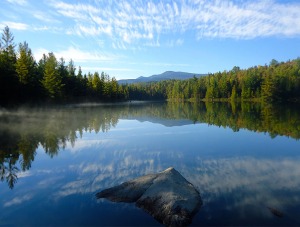
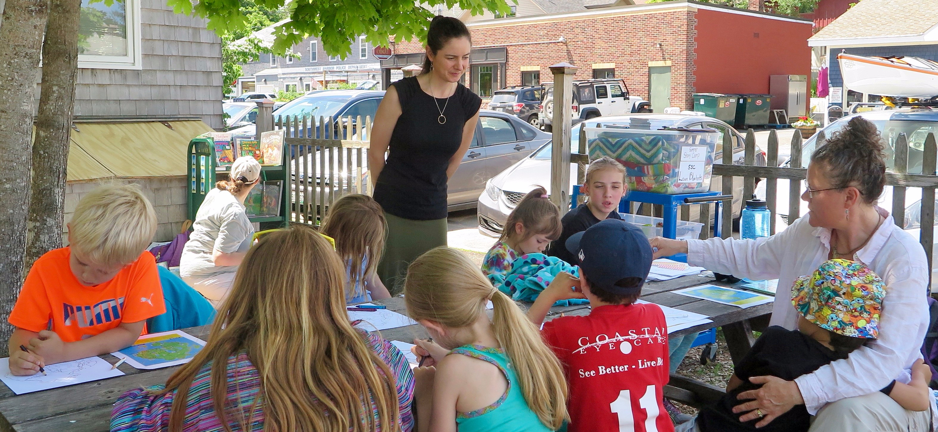
I recently had the pleasure to work with kids as a part of the Southwest Harbor Public Library’s Literacy Camp. The theme of their week was camping, so they had me come in to talk with them about my hiking guide.

The campers hiked up Flying Mountain, and while on top read the chapter in the book that describes Hattie’s – the main character in the book – experiences on the same trail. They were then tasked with writing down in their journals three reasons why people should hike Flying Mountain.

swhpl_literacycamp_jun2017-9-e1499550467222.jpg
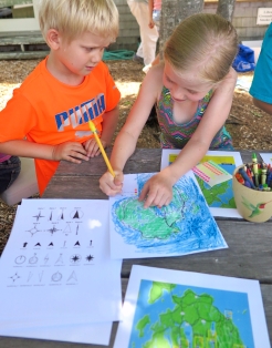
After the hike, I helped the campers create their own maps. Working from just an outline of Mount Desert Island, they used what they had learned about map symbology and conventions to symbolize the water, land, and roads on their maps. In addition, they identified places on their maps that were special to them. They completed the maps with a legend identifying their chosen symbols and other map elements like north arrows.

During a public event that evening during which I talked about my book, the students displayed their maps and their journal entries. I was so inspired by their reasons about why people should hike Flying Mountain that after I gave a reading of a chapter from my hiking guide, instead of talking more about it I read the children’s journal entries. Typically when I do a book talk, I discuss why I think it’s important for kids – and all of us – to get outside. The kids’ journal entires were so reflective of this that is was a perfect fit, the public enjoyed hearing the kid’s thoughts on this topic, and the kids themselves were quite proud I had read their work after reading from my book, I later discovered.

It was a great day for hiking, maps, and literacy!